

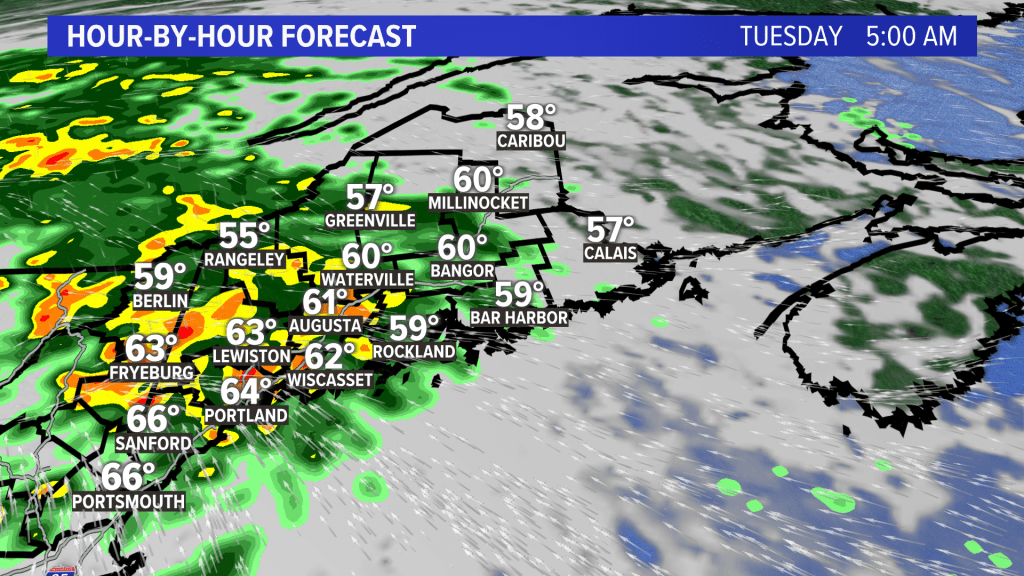
We are getting used to the same old story in northern New England this summer: rain, and lots of it. A strong storm will move into the region late Monday, with a warm front sparking showers later in the day.
By the time Tuesday morning rolls around, we’ll wake up to tropical downpours in southern Maine.
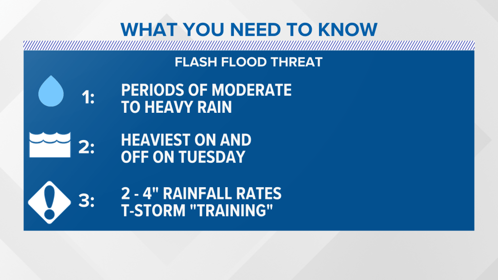
Rainfall rates will be in the 2- to 4-inch range during the peak of the storm Tuesday thanks to high available moisture in the atmosphere.
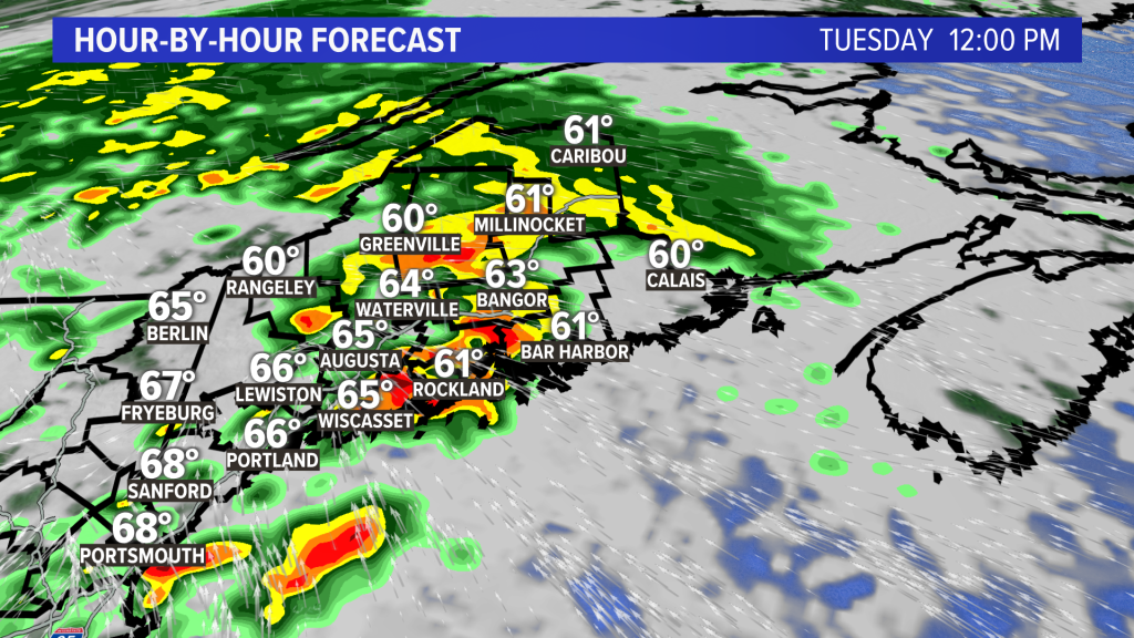
Some of the thunderstorms will “back build” and “train,” meaning they will go over the same towns repeatedly.
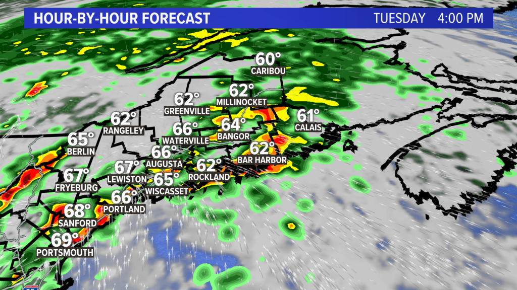
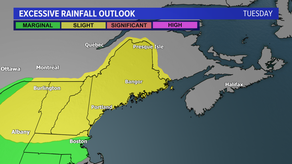
Despite less rain lately, the soil is still saturated from heavy summer rains, so the flash flood threat is a level 2 out of 4 for Tuesday.
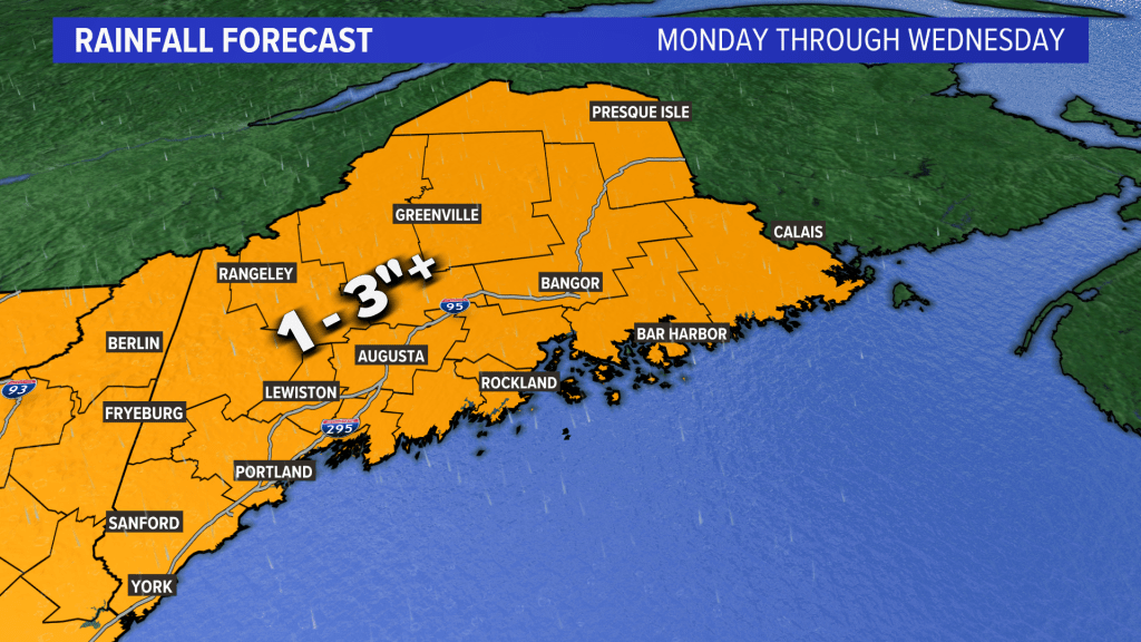
I expect around an inch of rain or more statewide, with more than 3 to 4 inches for localized thunderstorms mentioned above.
Here’s what you need to know in summary for the storm:
The rain will taper to showers, with the sun coming out Wednesday.
Copy the Story LinkSend questions/comments to the editors.
