In the heart of north central Aroostook County, a dozen miles south of the St. John River and the international boundary with New Brunswick and a half-dozen miles east of the Allagash Wilderness Waterway, is the Deboullie Public Lands unit. One of the most remote properties in Maine’s public lands inventory, the name Deboullie is an adaptation of the French word “déboulier,” which translates to “tumble down,” a reference to the many steep cliffs and talus slopes on the property.

The view south over the wilds of northern Aroostook County from the Deboullie fire tower. Photo by Carey Kish
Deboullie encompasses 21,817 acres of heavily forested mountain country, with 17 pristine ponds and a cluster of low but rugged peaks, the highest of which is 1,981-foot Deboullie Mountain. Deboullie’s summit, crowned by an old firetower (1929), offers a view that extends south over the Aroostook wilds all the way to Baxter State Park. A 7,253-acre ecological reserve within Deboullie protects the shorelines of 11 ponds as well as stands of old-growth spruce and mature hardwoods.
Until about a decade ago, there were few formal trails at Deboullie, mostly angler paths and old woods roads into the ponds and the trail along Deboullie Pond to the tower atop Deboullie. But the Maine Bureau of Parks and Lands, and the Maine Conservation Corps have changed that situation, constructing a superb 30-mile trail network that offers a wide range of day hiking and overnight backpacking opportunities.
Unless you’re an Aroostook County denizen, getting to Deboullie takes some doing. From my home on the Downeast coast, for example, it took me, with the requisite stops en route, about seven hours to cover the 270 miles, the last 20 miles on gravel logging roads.
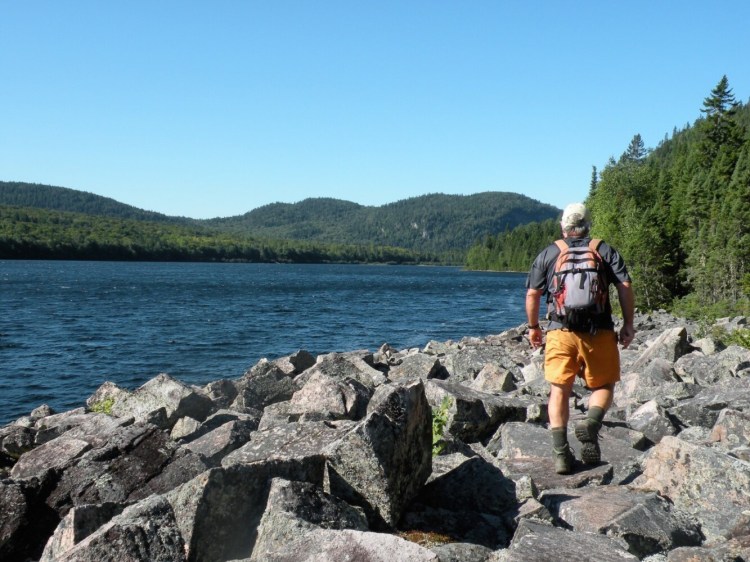
The long drive paid off handsomely, however, as I was treated to many miles of outstanding hiking and downright lonely pondside camping, just me, a few moose, several crazy loons and only a half-dozen other people over four glorious days. If you’re looking for prime natural beauty and lots of solitude, this is the place.
Parking the vehicle at the east end of Deboullie Pond, I pitched my tent at one of the 23 drive-in sites on or very near any of the six ponds. The primitive site offered only a picnic table and fire ring, and a nearby pit privy. Perfect, especially after I fished a cold beer from the cooler and wandered to the shore to admire the awesome view across the pond to the high ridgeline extending from Black Mountain to the Deboullie tower.
Over the next three days, I wandered hither and yon at Deboullie, doing three healthy hikes and covering all but a couple miles of trail. It was a tiring but rewarding endeavor that earned me a pretty thorough look-see around this beautiful chunk of wilderness terrain.
Each day’s hike was a loop that covered about eight miles. There are seven backcountry sites in Deboullie, so a backpack trip of several days is also possible. Next time for me. No matter which route you choose and how far you hike, you’ll likely have this remarkable natural gem of a place to yourself.

The view over Black Pond from Black Mountain. Photo by Carey Kish
The first hike combined the Black Mountain Trail over Black and Deboullie mountains with the southern half of the Deboullie Loop Trail over the north slopes of Deboullie Pond. The next day I followed the Deboullie Loop Trail along the pond, climbed up and down Deboullie via the Tower Trail, then finished up on the Whitman Valley Trail and then the Whitman Ridge Trail over Whitman Mountain.
On the final day, I hiked the Gardner Loop Trail, which ascends the twin summits of Gardner Mountain before dropping down to Gardner Pond and an awesome log shelter on Gardner Point. Circling Gardner Pond, I returned to the trailhead via the Denny Trail past Denny Pond.
Somewhere in my travels, I also knocked off the Crater Trail around Crater Pond.
Deboullie can be accessed from the north at Route 161 in St. Francis, or from the southeast at Portage and Route 11, journeys of 20 miles and 27 miles. Either way, you’ll have to pass through a North Maine Woods checkpoint, and pay day-use and camping fees (cash only).
To plan your own excellent Deboullie adventure, visit www.parksandlands.com and www.northmainewoods.org.
Carey Kish of Mount Desert Island is the author of AMC’s Best Day Hikes Along the Maine Coast and author/editor of the AMC Maine Mountain Guide. Follow Carey’s adventures on Facebook @CareyKish.
Comments are not available on this story.
Send questions/comments to the editors.


