

Air quality was a significant issue for most of Maine, except the coastline, to end the weekend.
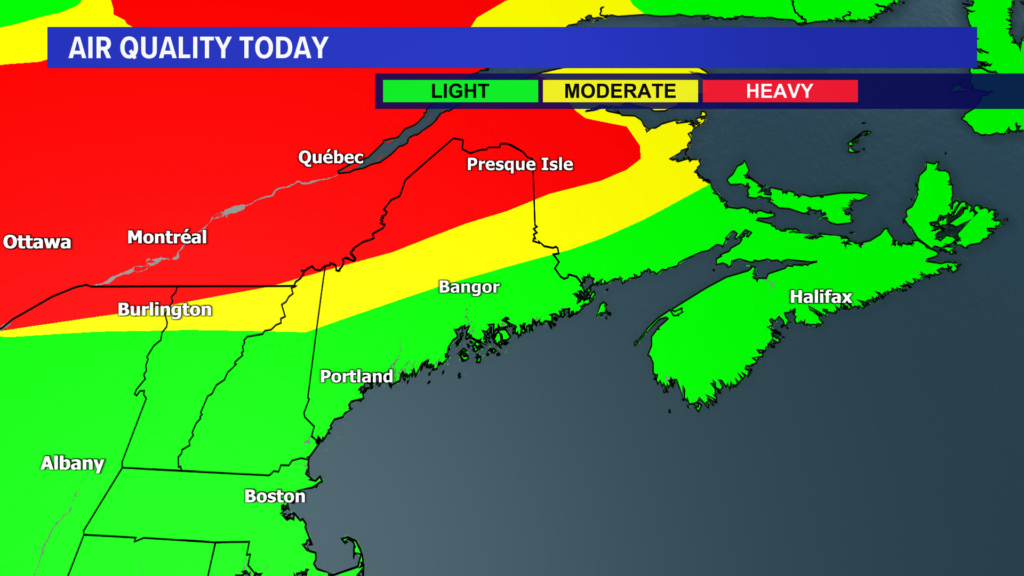
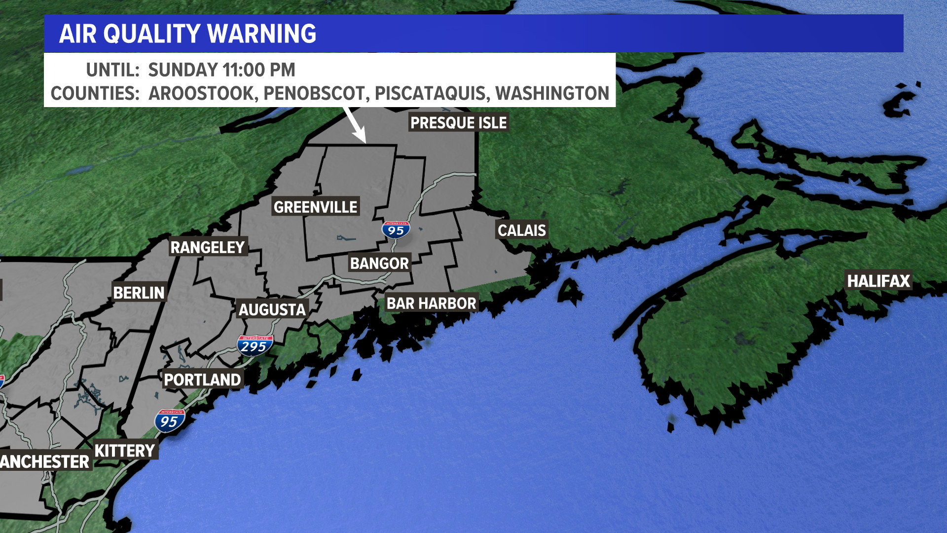
An air quality warning were in effect through Sunday night for nearly the entire state, with a code orange health alert. You can visit the AIR Now website for more information on the air quality situation.
A cold front that pushed south through most of the state Sunday night continued into this morning, pulling the wildfire smoke south.
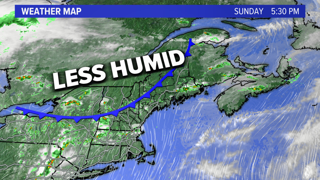
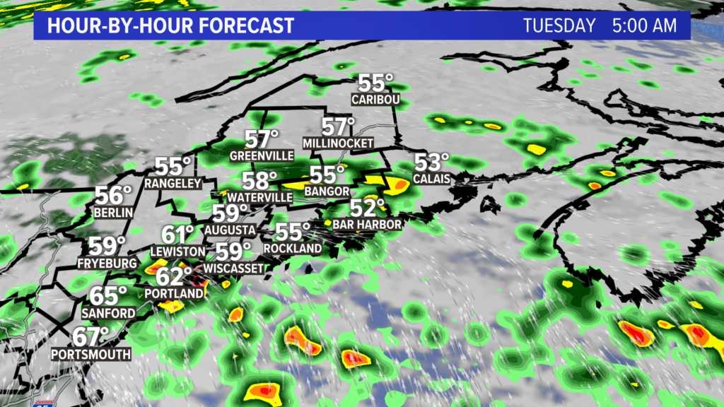
The air behind the cold front is much cooler, with highs struggling to reach the 70s today into Tuesday, with plenty of clouds. There will also be on-and-off downpours.
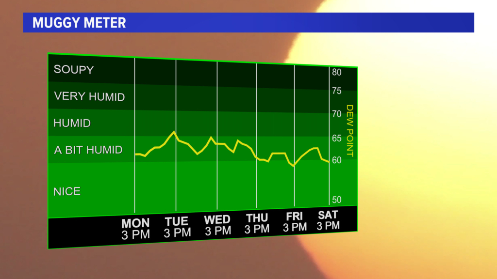
The muggy meter shows humidity levels remaining high into the next several days, with the summer feel here to stay, despite cooler temperatures.
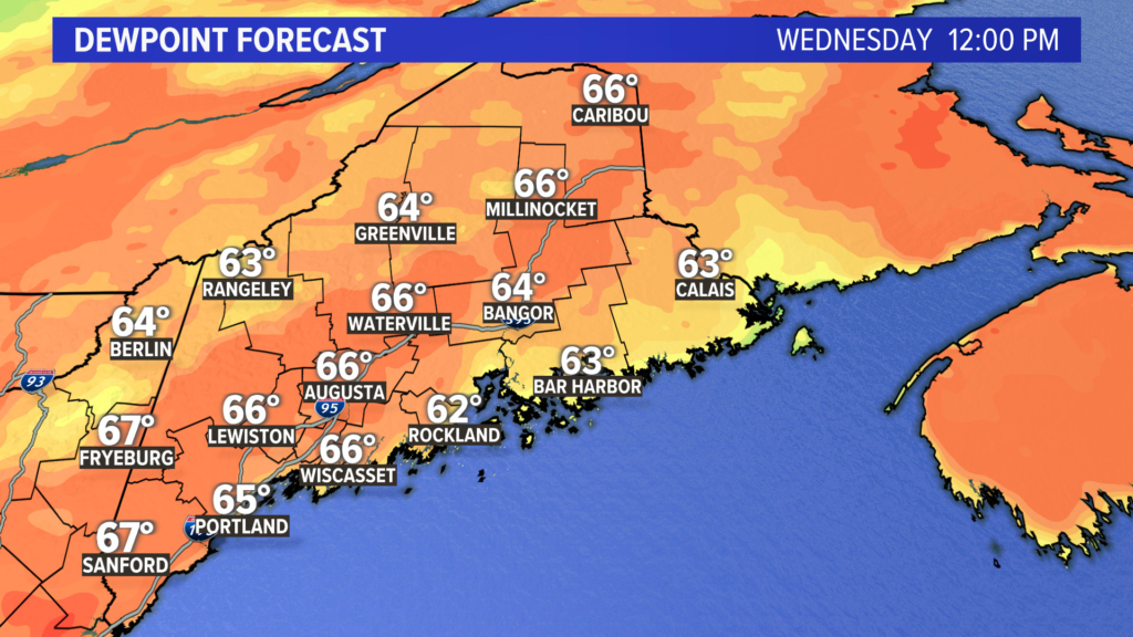
The dewpoint forecast shows numbers in the mid-60s and 70s well into the work week.
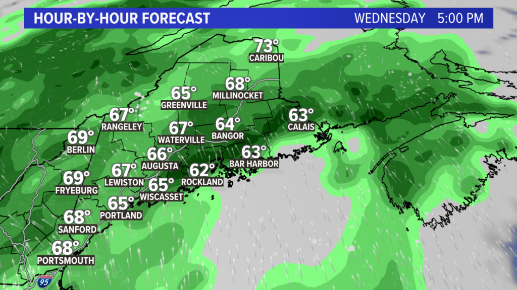
By midweek, the rain will still be around, with downpours continuing at times through Wednesday.
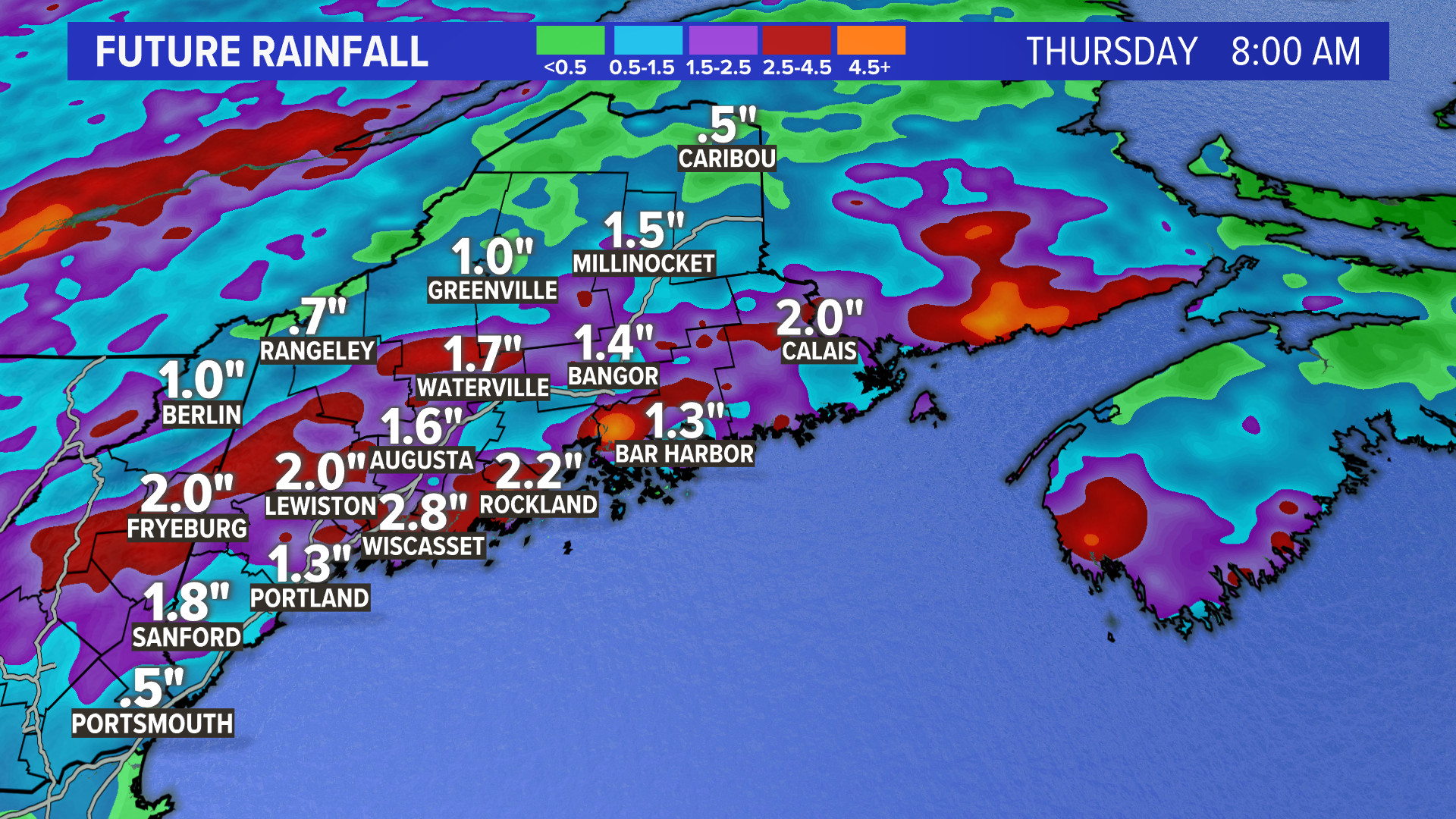
That will all add up to a few inches of rain and some localized flooding issues for area that get the hit-or-miss thunderstorms.
 Copy the Story Link
Send questions/comments to the editors.
