Colder-than-usual temperatures gripping Maine even as the calendar turns to spring are creating the conditions for increased flooding risks, a prospect that local officials are watching closely after unusually destructive flooding along the Kennebec River this winter.
“This has been a pretty active season already for flooding and although there are no flood threats now, things could change over the next few weeks,” Maine Emergency Management Agency director Suzanne Krauss said in a news release last week. “We will continue to monitor conditions so we are fully prepared.”
The River Flow Advisory Commission says stream flows are normal to much above normal, groundwater levels range from normal to above normal and reservoir storage levels are above normal for this time of year.
The ice jam on the Kennebec River that formed in January south of Augusta broke up two weeks ago and the river’s main channel is now open. The jam, which formed in mid-January, caused destructive flooding along the waterfront in Hallowell and prompted the closure of Augusta’s downtown waterfront parking for several days.
Concern over the ice jam prompted state emergency management officials to send two requests for ice-breaking operations to the U.S. Coast Guard on the Kennebec River.
The commission said flood potential is above normal across Maine because of more snow and higher snowpack levels. Rainfall quantity and duration is the most significant risk factor in Maine flooding, and for the next 6 to 10 days, there is a 50 to 60 percent chance that temperatures will be below normal and there’s an equal chance there precipitation will be above or below normal.
“The longer we go with low temperatures, the greater the threat of a quick melt, which is why I predict an above-average threat of flooding this season,” said National Weather Service meteorologist Tom Hawley.
Temperatures in central Maine started out in the single digits Monday and climbed to 30 by the afternoon, with high temperatures the rest of the week expected in the mid to upper 30s.
The Kennebec Emergency Management Agency continuously updates municipalities in central Maine of flood risk and warnings from the National Weather Service in Gray. Director Sean Goodwin has been sending messages to the agency’s flood group almost daily after facing criticism that not enough was done to alert business owners and residents in Hallowell of the potential flooding in mid-January.
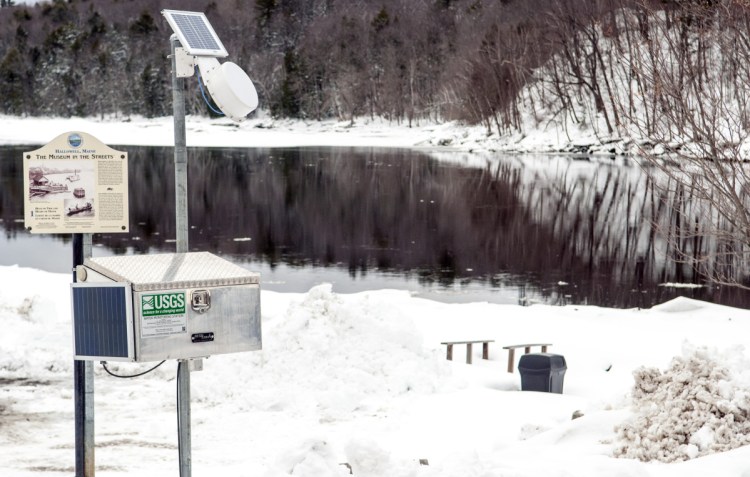
In Hallowell, a new flood gauge was installed last month and is monitored by city officials, including Police Chief Eric Nason, Fire Chief Jim Owens and City Manager Nate Rudy, as well as a county and state EMA representatives.
Goodwin said the weather has started to play a game on everybody because the longer it stays cold, there will be snow and ice build up. Eventually, he said, things are going to warm up, and if there is a lot of snow and ice around, rapid melting could cause flooding.
“All of us need to be watching the river for the next few weeks,” Goodwin said. “It’s going to melt. We just want a slow melt.”
Rudy said Monday that the new flood gauge is working well and the city hopes to make it a permanent fixture.
“I have no information on any concern for flooding at this point,” Rudy said. “We have to hope for a slow thaw and warming cycle so that the snow can melt steadily through spring.”
Statewide, Maine is at normal or the upper end of normal for stream flow and groundwater, said Nicholas Stasulis, a data section chief for the U.S. Geological Survey. Water levels were low in the fall, but the storm in late October and the January thaw helped bring water levels up, he said.
The latest gauge information for about 80 flood gauges statewide is available by visiting waterwatch.usgs.gov.
“These gauges are important in helping emergency managers and the public plan for potential flooding,” Krauss said. “MEMA is pleased to partner with the U.S. Geological Survey and National Weather Service to provide this extremely valuable information.”
The river flow commission is scheduled to meet again in early April to provide an update on conditions around the state.
Jason Pafundi — 621-5663
Twitter: @jasonpafundiKJ
Send questions/comments to the editors.


Comments are no longer available on this story