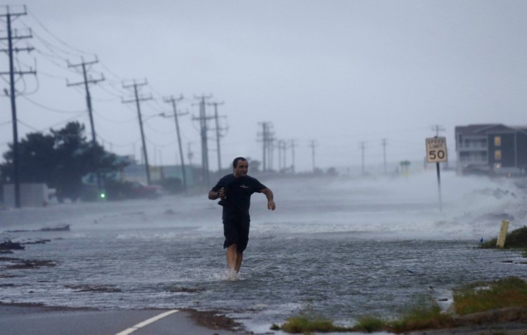
The National Weather Service on Friday issued a flash flood watch through 6 a.m. Saturday for the Maine coast from Kittery to Belfast as Hurricane Arthur continued its blustery trip up the Eastern Seaboard.
The hurricane, the first of the season, is expected to dump as much as 5 inches of rain in Down East Maine and comes just two days after torrential downpours hammered western and central Maine.
As of 9 p.m. Friday, Arthur was passing over Nantucket, according to weather radar.
Hurricane Arthur will give Maine just a glancing blow in terms of its ferocious winds, but the storm and a weather front stuck over the state will produce plenty of rain through Saturday morning that could cause flash floods in coastal areas.
Rainfall amounts will increase “as you head up to the midcoast and Down East,” said Mike Kistner, a meteorologist with the National Weather Service in Gray.
The storm will pump moisture up the coast, but heavier winds should stay offshore. Winds over the Gulf of Maine could be 50 mph or greater, according to meteorologist Margaret Curtis, also with the weather service’s office in Gray, but aren’t expected to be stronger than 20 mph in Portland.
While the storm could dump up to 5 inches of rain Down East, Curtis said southern Maine will see much less.
“Here in Portland, we’re just expecting a bummer of a rainy Fourth of July to continue, and looking for an inch and a half of rain total through the overnight,” she said Friday night.
Hurricane Arthur was forecast to make its closest approach to the state just after midnight Friday, moving up the eastern side of the Gulf of Maine, Kistner said, before making landfall in Nova Scotia around sunrise Saturday.
There’s a chance of light rain early Saturday morning, he said, but after that skies should clear, and cooler, less humid air will move in.
Saturday afternoon and Sunday look nice, with highs in the upper 70s and low 80s in southern Maine. However, despite the sun’s appearance, Curtis warned that the hurricane will continue to churn up rough seas and heavy surf and create riptides Saturday and Sunday.
“One thing to keep in mind as the sun appears is that the storm will still be offshore, so folks heading to the beach should be aware of high surf and rip currents that can drag swimmers out to sea,” Curtis said. “So definitely be alert.”
The stormy weather disrupted many people’s Fourth of July plans. Fireworks shows were postponed in Portland and elsewhere in the state, and Nova Star Cruises canceled its scheduled sailing from Portland to Yarmouth, Nova Scotia, Friday night and its return trip from Canada to the U.S. on Saturday morning.
Mark Amundsen, president and chief executive officer of the ferry line, said the hurricane is expected to cross the Gulf of Maine about the same time as Friday night’s sailing, which was scheduled to depart Portland at 9 p.m. and arrive in Nova Scotia around 7 a.m. Saturday. Instead, he said, the Nova Star would stay tied up in Portland after arriving Friday night and resume service starting with Saturday night’s trip.
Passengers with tickets for Friday night’s trip were notified by email, Amundsen said, and can change or cancel their reservations at no charge.
Saturday night’s trip calls for the ferry to leave about the time that Portland’s fireworks, delayed from Friday night, are shot off. Kistner said the ferry should depart without a hitch.
Areas in western and central Maine were still recovering Friday from the storm Wednesday that dropped several inches of rain and caused power outages for several thousand people. Rumford was particularly hard hit on Wednesday, with an estimated 4 to 6 inches falling on the town in two hours. The microburst washed away roads and rerouted streams. On Friday, the rain hadn’t worsened the situation in Rumford, though South Rumford Road remained closed from Wednesday’s storm, according to a dispatcher at the Oxford County Sheriff’s Office.
As of 9:50 p.m. Friday, Central Maine Power Co. was reporting 225 customers without power, most of them in Somerset, Oxford, Lincoln and Cumberland counties.
Send questions/comments to the editors.


Comments are no longer available on this story